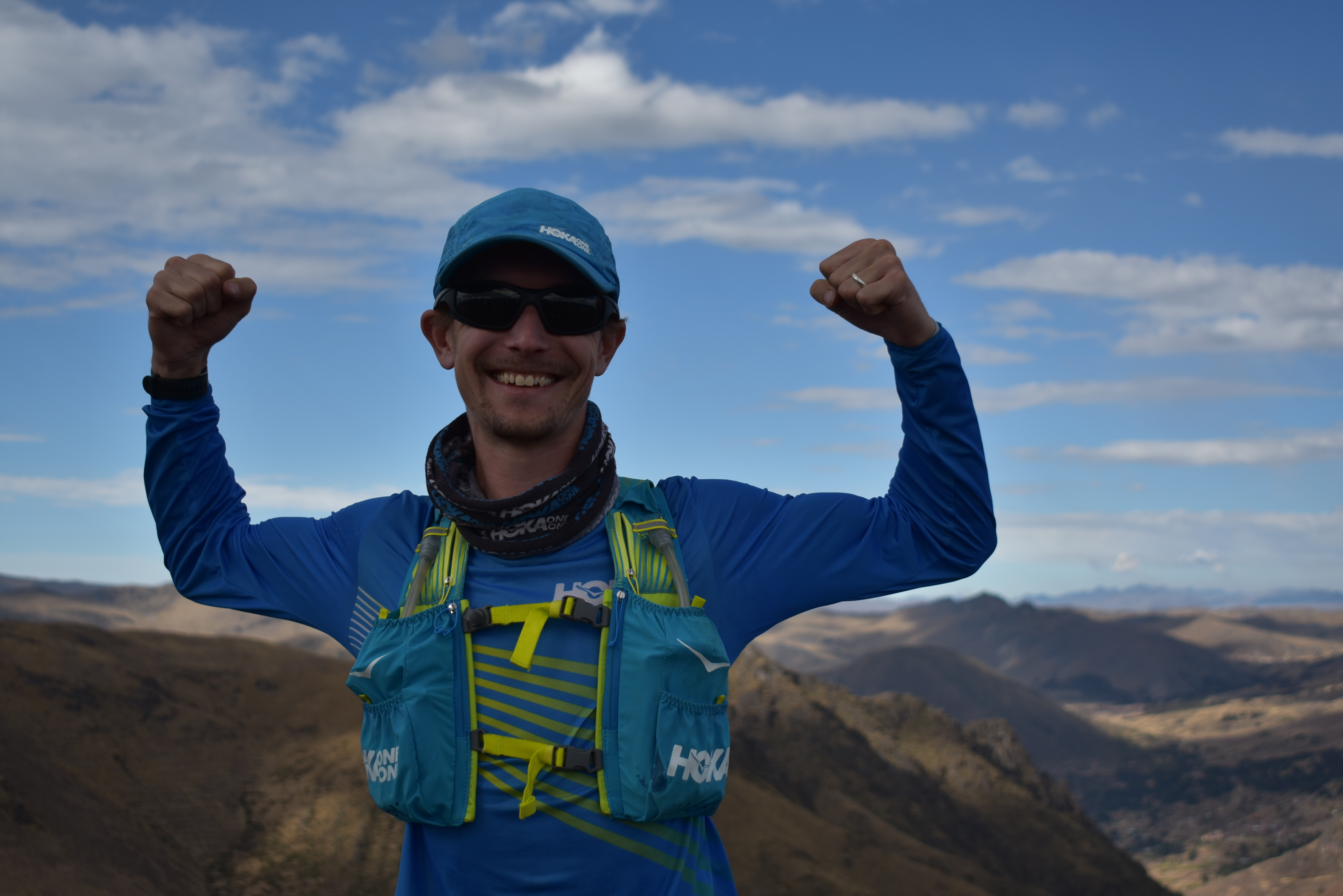
On Friday, August 2, STRIVE’s own Tyler Andrews set out for his first competitive trail run. In attempting to set the Fastest Known Time on the Salkantay Inca Trail, he broke the previous record by over two hours, finishing the 61km high-altitude route in just 6 hours and 13 minutes.
He shared some insight into his record-breaking debut below.
You can also read the Official Press Release here and view his GPS Track via Strava here. A short video with footage from the run will be coming soon.
If you have questions or interview requests, please contact Media@strivetrips.org.
(All photos of the trail by Melanie Ng and are not from the actual FKT run but showcase the route well.)
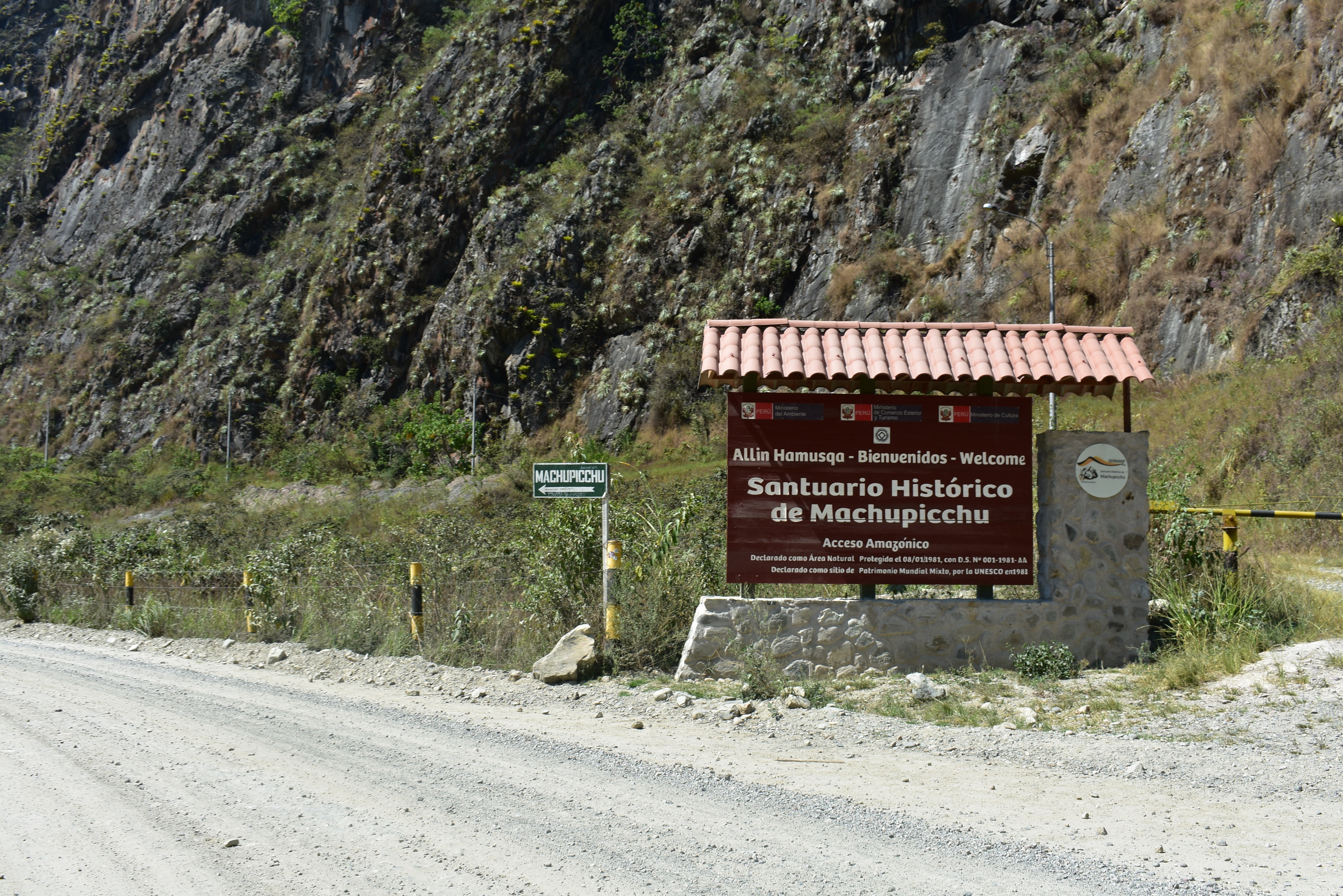
What is the Salkantay Inca Trail?
It’s the most beautiful and the most challenging of 3 Inca Trails to Machu Picchu. All three trails start in various parts of the Andes and finish at the New Wonder of the World after covering 30-60+ km of high-altitude mountain scenery.

The Salkantay Inca Trail is named for Salkantay Mountain, which towers above the highest pass.
Why try to set the Fastest Known Time on the Salkantay Inca Trail?
I love it and I’m familiar with it. Part of my reluctance to enter the trail-running world in general has been my lack of confidence running on trails. I’ve hiked Salka probably 5 to 10 times over the last 9 years of working with STRIVE in Peru. I know every turn and every campsite and have even run several sections before. Plus, I have tons of positive memories to draw on from so many great hiking trips with great folks. Overall, it seemed like a fairly low-pressure way to try something about which I was both excited and nervous.
I may not be experienced running on the trails, but I love the Andes Mountains and I was ready for an adventure.
What was the plan?
Normally, the route, which covers about 64km from Soraypampa to Machu Picchu Pueblo (A.K.A. Aguas Calientes), is done in 4 days of hiking. My goal was to set a new FKT — the previous best was 8h19 from 2013 when a race was held on the route.
I planned to do the entire run unassisted, meaning that I’d need to carry everything with me from the start that I wanted on the route, the only exception being water which I was allowed to restock on during the attempt.
I’d broken the run into chunks based on my hiking experience, each one separated by a campsite, high pass, or other landmark. I’d conservatively estimated by time in each of these chunks (based on really nothing but pure speculation and the one short run I did on the route in 2018) and these added up to about six and a half hours. With the FKT at 8 hours 19 minutes, it seemed like even if my math was a bit off, it was realistic to try to shoot for the FKT.
How’d it go?
I slept in Soraypampa under a beautiful but frigid sky and woke to a similarly bitter cold, crystal clear morning. The route starts right between two giant snow-capped mountains, Humantay and Salkantay, at about 3800m.
Unlike most longer efforts that I’ve done, this was odd because the route starts with a hard climb from 3800m to 4636m, so basically one minute into the run I felt like I was redlining and really just regretting my decision to try to do this and feeling sorry for myself.
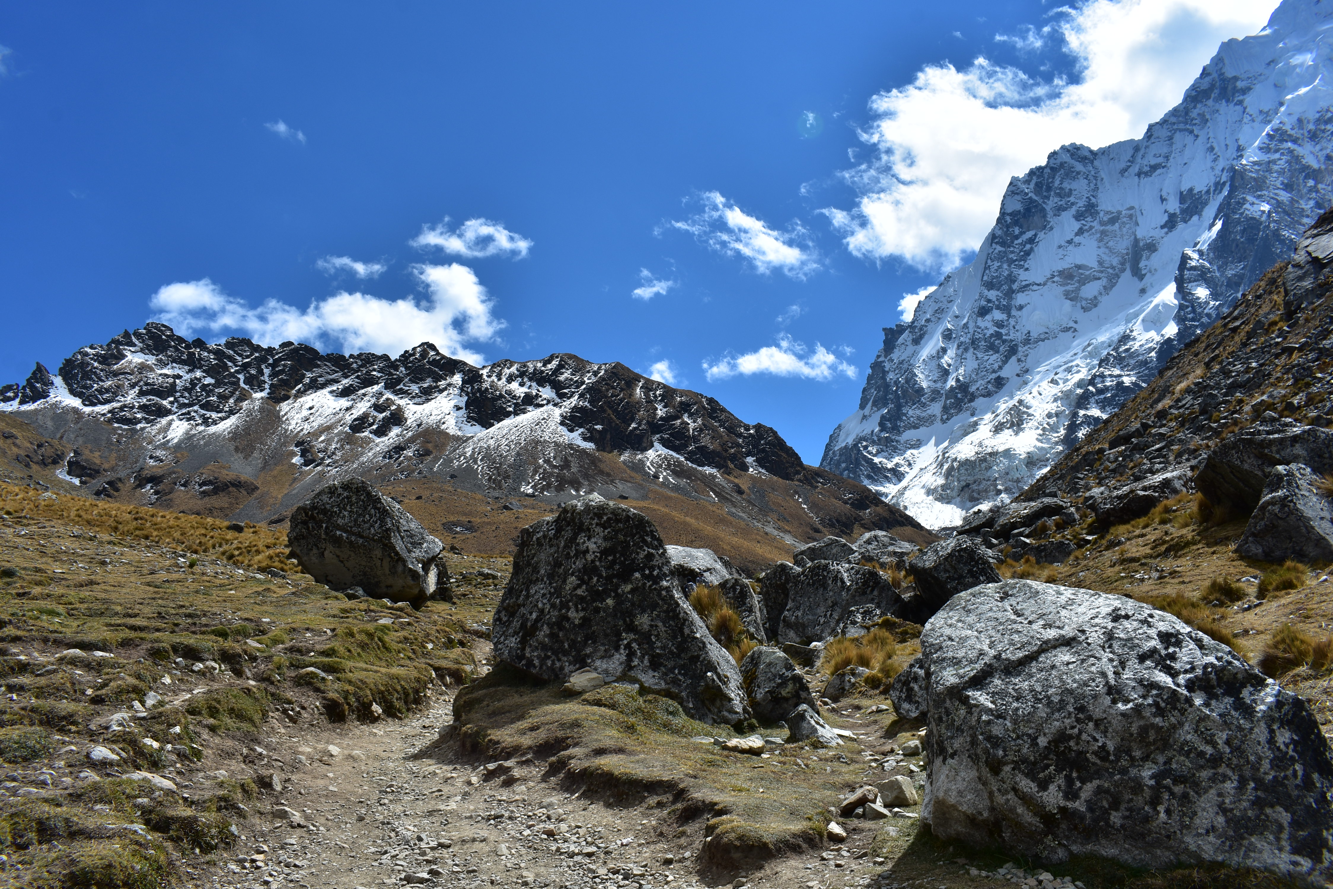
The start of the trail snakes up to a 15,100 ft high pass between Salkantay and Humantay Mountains.
But I had plenty of energy and made it up to the high pass with a combination of walking and speed hiking on the steeper parts (shout out to my boy Patrick Reagan who taught me there’s no shame in speed-hiking and it’s actually often more efficient at the same pace) and was through the first 7km, 800+ meter climb in 51 minutes. Popping up over the pass and seeing the giant snowcaps far ahead with a huge blanket of clouds over the cloud forest was pretty spectacular.
The gnarliest section of descent on the run follows this beautiful high pass. It’s very high, steep, and rocky. My number one goal for this run was no season ending injuries and so I was very cautious and conservative as I made my way down. The terrain got gentler and eventually we passed my next mental checkpoint (the day 1 campsite in Huairaspampa at 3900m). This turned out to be one of my favorite stretches of the route as it was early enough that there was no one on the trail at all except me and the viscachas (wild mountain chinchillas) and a few random cows.
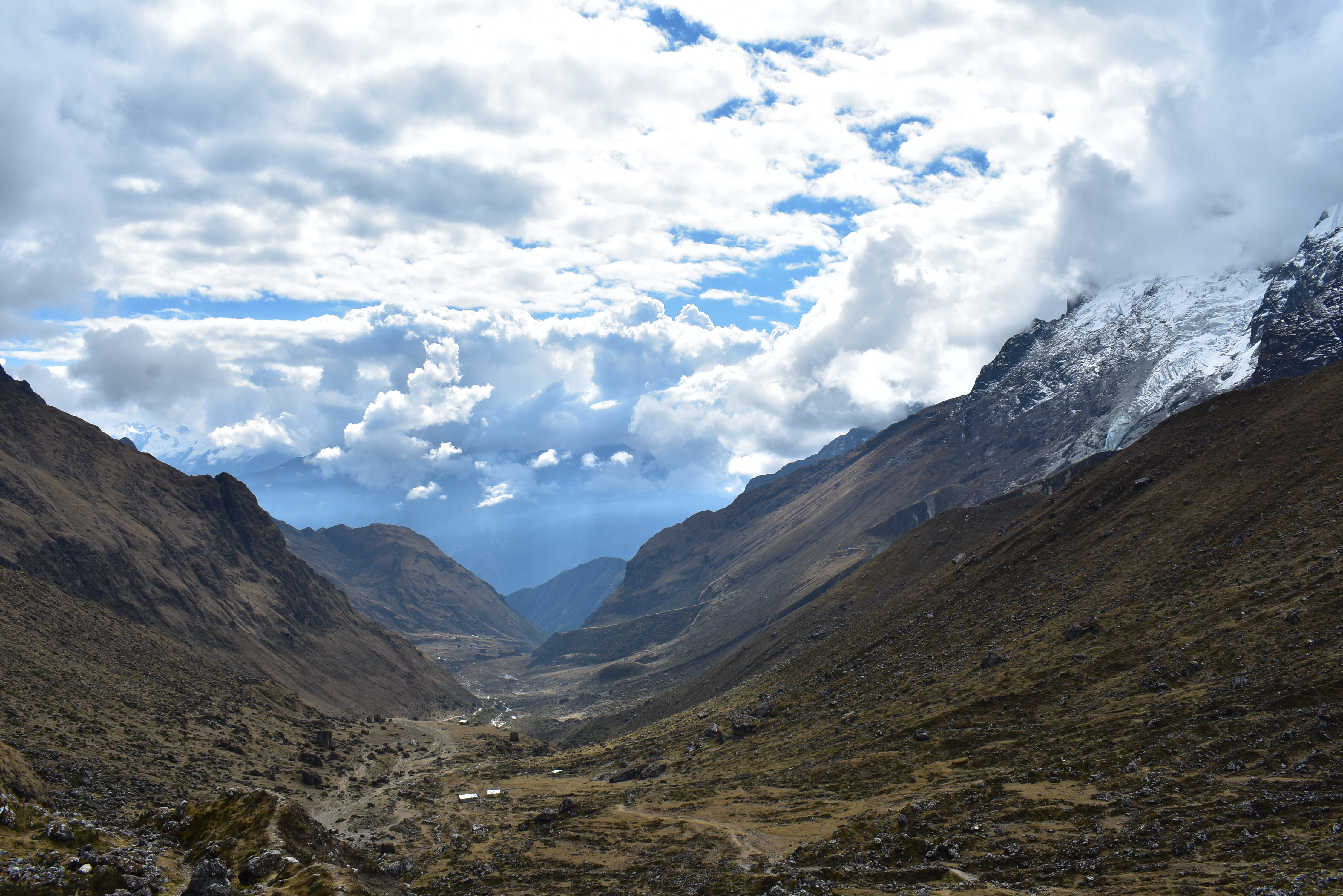
The descent from the high pass into the cloud forest below.
The next stretch until Chaullay was probably the most frustrating of the whole day. I felt fine and the terrain and trail were lovely and it was starting to warm up, but I had to stop close to a dozen times for trains of horses heading up trail to meet the hiking groups and carry their stuff. It wasn’t a huge deal but definitely broke up my momentum a fair amount and made this stretch feel a lot longer than it was.
Finally, I passed through Chaullay almost exactly on my predicted pace (around the 2h20 mark) and had arrived at by far the most runnable section of the course — a fairly continuous downhill stretch, much gentler than the previous descent, which stretch lasted almost 18km. I’d run this stretch many times with the STRIVE gang over the years and knew it would be a good chance to just cruise and zone out.
The gloves came off as the sun came out and the trail plunged down into the high jungle.
And so I did. I put my headphones in for the first time and tried to just let myself relax and fall down the trail. I was comfortably running around 4’00/km or faster and it felt good, like I hadn’t already been moving for 2.5 hours through the mountains.
I’d ditched my top layer, hat, and gloves, and the only issue I found myself dealing with was the bottle vest I was wearing which — due to the relentless downhill of the run — was bumping up and down and chafing my shoulders.
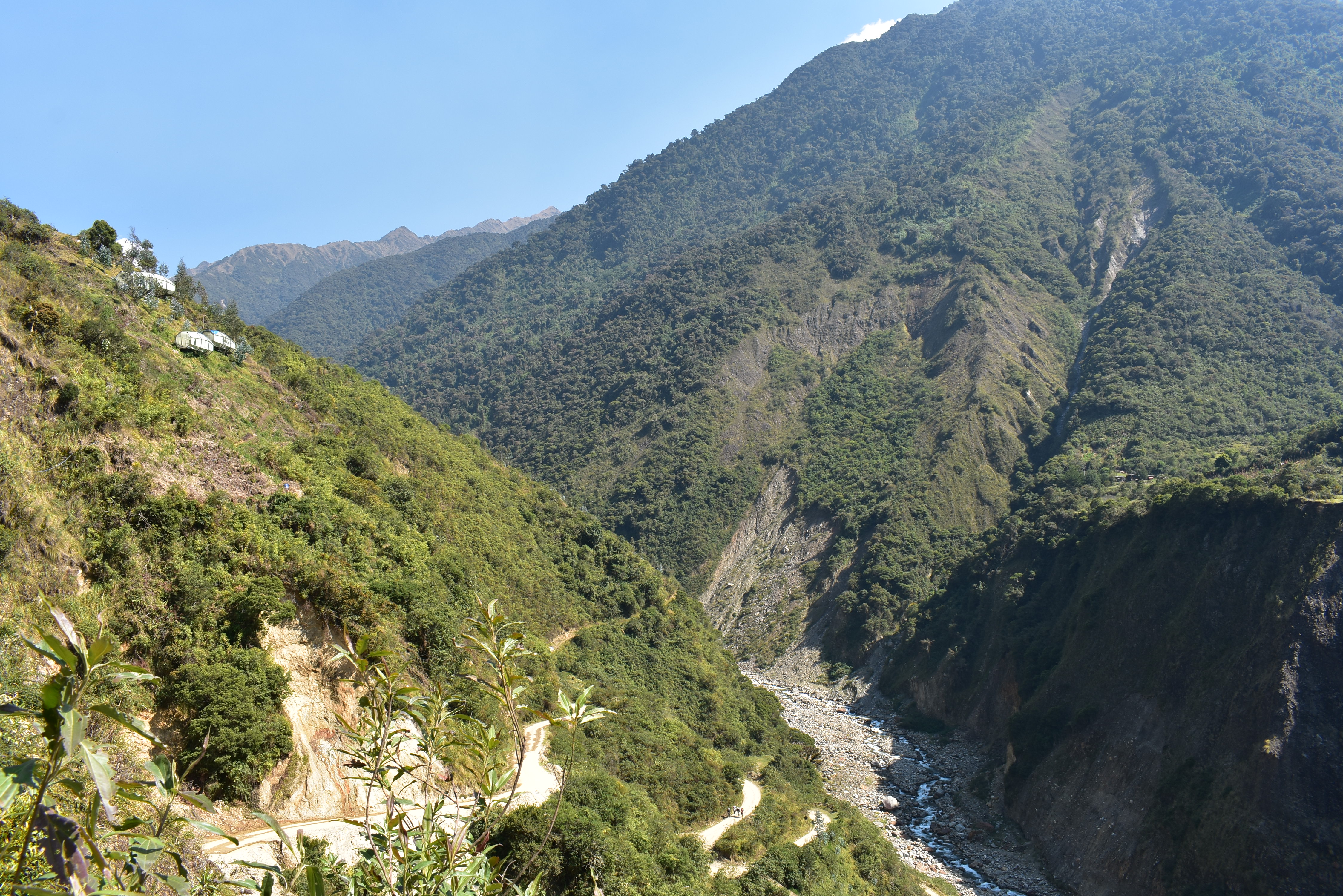
I ended up just carrying the two bottles which made the vest tolerable and before I knew it, I was passing the first bridge at La Playa and then a few minutes later arrived at Lucmabamba at about 2000m.

At 2000m of altitude, the environment is seriously tropical.
My average pace had dropped below 6’00/km for the first time thanks to that fast last section, but I was now about 3.5 hours in and was starting to feel very hot at the lower altitude and as the sun came up.
Just as I turned onto the last significant climb of the route from Lucmabamba to Llaqtapata, I saw one of my students who had spent the night there and was leaving late. A little voice in my head told me, “You could just stop and get in the car with Peter.” But, I’ve had lots of experience telling that voice to hush and so continued upward.
This climb ended up being much more challenging than I expected. I thought it would feel much easier than the first climb, since it was about the same total amount of climbing but at a MUCH lower altitude (2000 to 2800 instead of 3800 to 4600m). But the fatigue in my body at that point and the extreme heat and sun as I climbed the exposed trail made it feel much harder and longer than it was.

Climbing up from the river below to the top of the mountains on the right and down the other side.
I realized about halfway up that I had not brought nearly enough liquid. I had drank one 18 oz bottle of Maurten 320 in the first 2.5 hours and had gone through most of an 18oz bottle of nuun and only had about half of my second 18 oz maurten bottle. Luckily, I knew there was one little trail-side stall near the top and so I focused on just getting there and stopped to buy another 750mL of water.
It was a mental boost to have some cold water and I was almost at the top by then. Finally, the trail tucks into the forest — a bit shady — and then tops out and begins the steep descent down. I think I gave out an audible howl at the top as I knew this was the end of the last really serious climb.
After a few minutes, the trail literally pops through an old Incan structure (Llaqtapata) and into a clearing with the first view of Machu Picchu. I could finally see the end point.

The first glimpse of Machu Picchu (center, just in front of the dome-shaped mountain) from Llaqtapata.
Down, down, down the steep, unrelenting zig-zag path to the river, almost 900m down in just a few km. I was actually feeling great at this point, and knew I was still making great time despite slowing a lot on the previous climb. I passed a lot of hikers who gave me some very weird looks but were all extremely generous with giving me space to go by.
As I saw the bridge at the bottom of the trail, I again gave a big whoop as now I knew that the hardest ups and downs were all done — the remainder was relatively flat.
Across the bridge and onto the dirt access road to Hidroelectrica. I actually felt very good getting back into a real run on this stretch and was running again close to 4’00/km which is by far the fastest I’ve ever run at this point in an effort (close to 5 hours now).
The first signs for Machu Picchu, approaching the Hidro Electric station.
I saw Matt a few hundred meters before the hidro control point and he confirmed that he’d been able to register me so I could just run through — great! A few minutes later, passing Hidro, I passed the STRIVE group which was a great energy boost before the last kilometers along the train tracks.
I always forget how steep and long the climb up to the train tracks is. Once there, though, it was a straight shot all the way to Puente Machu Picchu. I started off feeling good and was again running under 4’00/km on the rocky path along the side of the tracks, but gradually began to feel more and more tired. What started off as 4’00/km pace became 5’00/pace and then even slower. A few times, I stopped to walk just because I felt really tired and overheated and couldn’t catch my breath, something I’d never experienced before.
This stretch is long and arduous even when walking and felt similarly interminable when running. Once we got close to Putucusi Mountain, I knew that the tracks hit the road basically on the other side of its steep face, but it just took a long time. Finally, I came around the corner where the dump is and I almost cried — I’d never been so happy to see a pile of garbage.
Once the trail hits the road, it’s about 2km uphill along the dirt access road into Aguas Calientes Plaza where the route officially ends. That stretch never felt as steep as it did then. I felt like I was running as hard as I could and barely running under 6’00/km pace. I seriously thought I was going to have to stop and walk like 300m from the end as the road really steepens coming up into town.
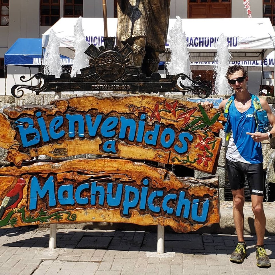
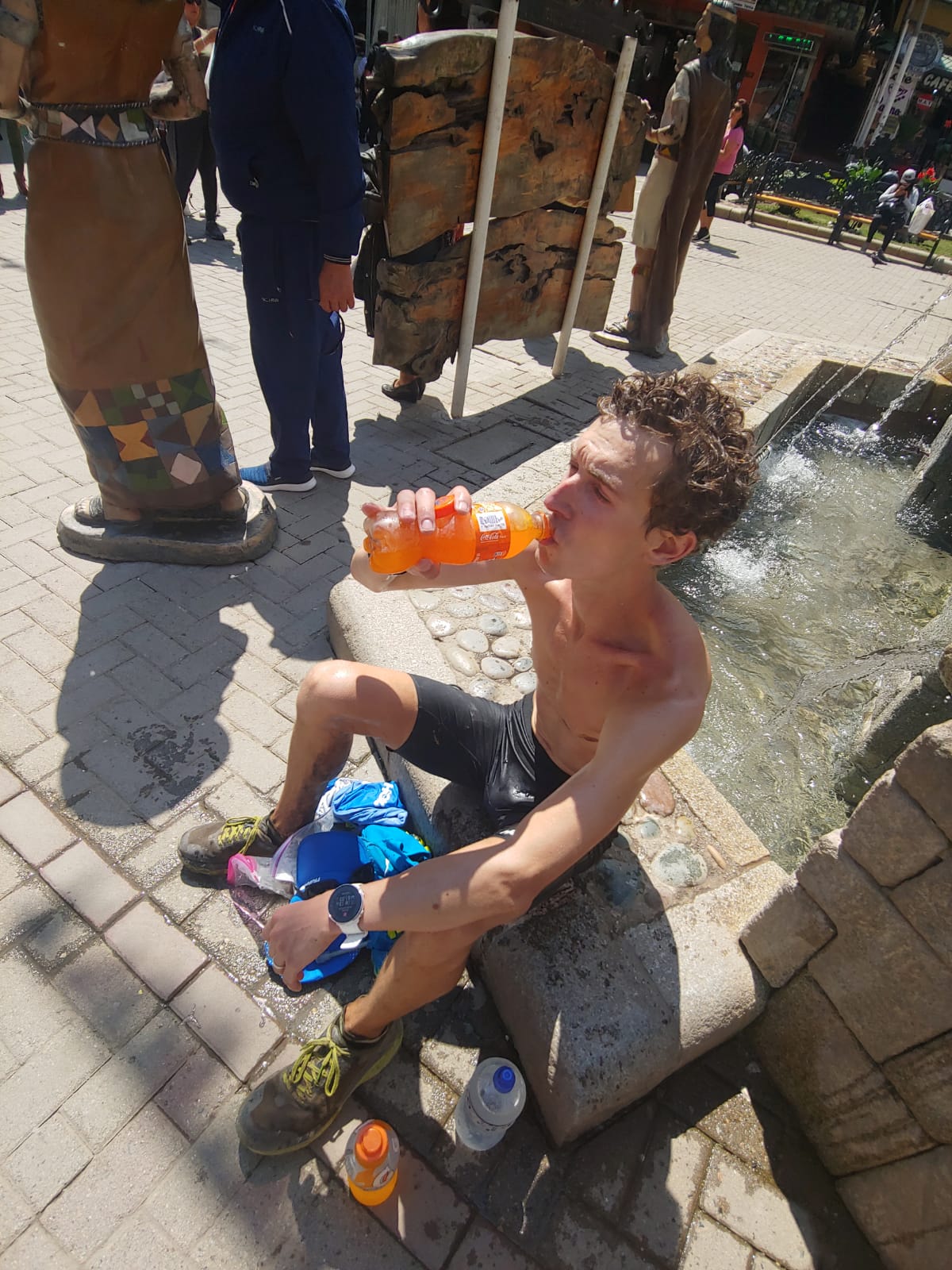
But, I didn’t. I zipped through a stream of tourists and ran the last stretch into the main plaza and slapped the giant ‘BIENVENIDOS A MACHU PICCHU’ sign and then sat down and put my head in the fountain.
This was after dunking my head in the fountain and drinking a lot of liquid.
The final time was 6’13’03, a full 2 hours and 6 minutes under the old mark.
Matt was there to capture the finish and — very generously — take charge of getting me some sugary liquid to splash down (where’s my Fanta sponsorship at?!). It took a little while but I was able to get moving and, after a hot shower, was feeling more human.
What did you learn?
I feel like I learned an awful lot in these 6 hours of relentless forward motion.
I learned specific things like not to wear a singlet under my bottle vest (I’ve got huge chafing wounds on my collar bone and shoulders) or that I need more liquid than I thought I did. But I also learned bigger lessons that apply to all types of Running. I learned about the importance of being able to compartmentalize and stay in one section, to not think too far ahead and not recall too far into the past.
And I learned that there’s always more at the bottom of the well than you think there is — or maybe I just learned that my own personal well extends a bit deeper than I’d realized before.
Refilling the well.
But maybe most importantly, I learned, reminded myself, really, how much I love covering ground quickly, how much I love the mountains, and how much I love pushing myself. Today was the first time I’d really experienced all three of those loves in one outing.
I often scrawl a phrase or mantra on my arm before a big effort like this. Honoring my angsty high school days, I chose a line from The Used’s “Taste of Ink”: “Savor every moment of this.”
I wanted to remind myself that when — not if — things got hard, that that was part of the privilege of this undertaking. Running almost 40 miles through some of the most spectacular scenery on Earth is a memory for which I will be forever grateful. A few hours of discomfort and a few days of soreness is a tiny price.
Will we see you on the trails again?
The short answer is — maybe! Right now, I’ve already got my fall (and winter) seasons pretty well mapped out. I’ll be running 50K (road) World Championships on September 1 and then the US Olympic Marathon Trials on Feb 29, with maybe another marathon in between those two. Beyond that, though, I’m not sure. I did have a blast but the trail world is a wide and varied one and I’m still such a novice that I think there’s a pretty steep learning curve for me to really be competitive. We’ll see!
Anything else?
Lastly, many thanks to everyone who made this possible, especially the folks at HOKA, STRIVE, and Ronnie Villalobos who all provided support and helped coordinate logistics. Thanks as well for support and supplies on the trail from nuun, Maurten, Shady Rays, (and of course HOKA as well). Thanks to everyone on the trail who cheered me on, especially the STRIVE Peru gang who gave me a huge boost and let me do my own thing for a couple of days. Special thanks to Matt Weickert for being there at Hidro and the finish and along the way to offer encouragement and give me a good excuse not to walk (too much). And thanks to all my family, friends, and fans who’ve encouraged me to chase my dreams, however crazy they might be.
Very cool. Good job, buddy.
[…] summer (2019), I ran 64km (~40 miles) to set the Fastest Known Time on the Salkantay Inca Trail. It beat me up in a way I’d never experienced before but filled my heart with the joy of a golden […]