Click here to read all of the posts in the “Where have I been?” series (if you haven’t you should probably start from the beginning, before you read on!) Also, you can click on any of the photos for a bigger version.
Part VI: Ushuaia, Argentina to Sierra Valdivieso Forest
I can feel the distance.
Ushuaia is rightly known as the Fin del Mundo – the end of the world. As the most southerly city on Earth, Ushuaia is closer to Antarctica than it is to its country’s capital, Buenos Aires.
And it feels like the end of the Earth. Landing at the one-runway airport brought us strikingly close to the jagged snow-caps that stretch out from the city, an intense wilderness in every direction. I have the (seemingly common, now) feeling that we’re about to crash into said wilderness until – again, as always – civilization pops up at the last minute. One road. A few dotted houses. And then the cove appears, full of life and commerce. Wheels touch down.
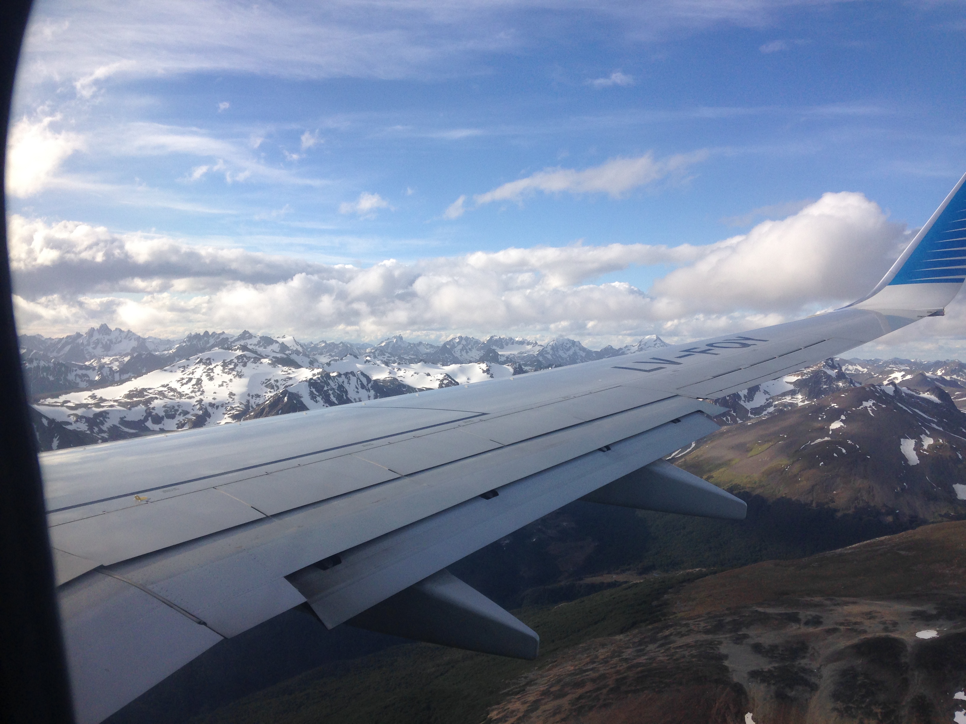
Landing in the Wilderness
It’s just past the summer solstice and the days never really end. Dusk rolls in around 11:30pm and Night tries valiantly to take hold. The sky reaches a dark blue, but never fully black. Dawn comes just a few hours later.
It’s disconcerting, but also inadvertently fills each day with opportunity. So many hours! So much time for activities!
Mariana and I have consulted a little book (“Trekking in the Patagonian Andes”), which outlined a few dozen hikes of varying levels – from two-hours strolls to fifteen-day expeditions. Our hike in Bariloche had been a bit of a warm-up for what we were hoping would be an intense, but rewarding, trip into the back-country around Ushuaia.
The route we’re planning to walk is called the Valdivieso Circuit. Unlike the well-traveled and well-marked trail in PN Nahuel Huapi from the week before, this circuit has no actual trail and sees a only few dozen visitors each year (a fact that was reinforced by the lack of name-recognition on the faces of local hiking store employees when we mentioned where we were headed).
It’s a big step. I have never been in true back-country, relying only on a map and compass (and hand-held GPS device, in our case) to navigate. I’ve done some serious route finding and plenty of navigating, but this will be pushing my boundaries. I’m excited.
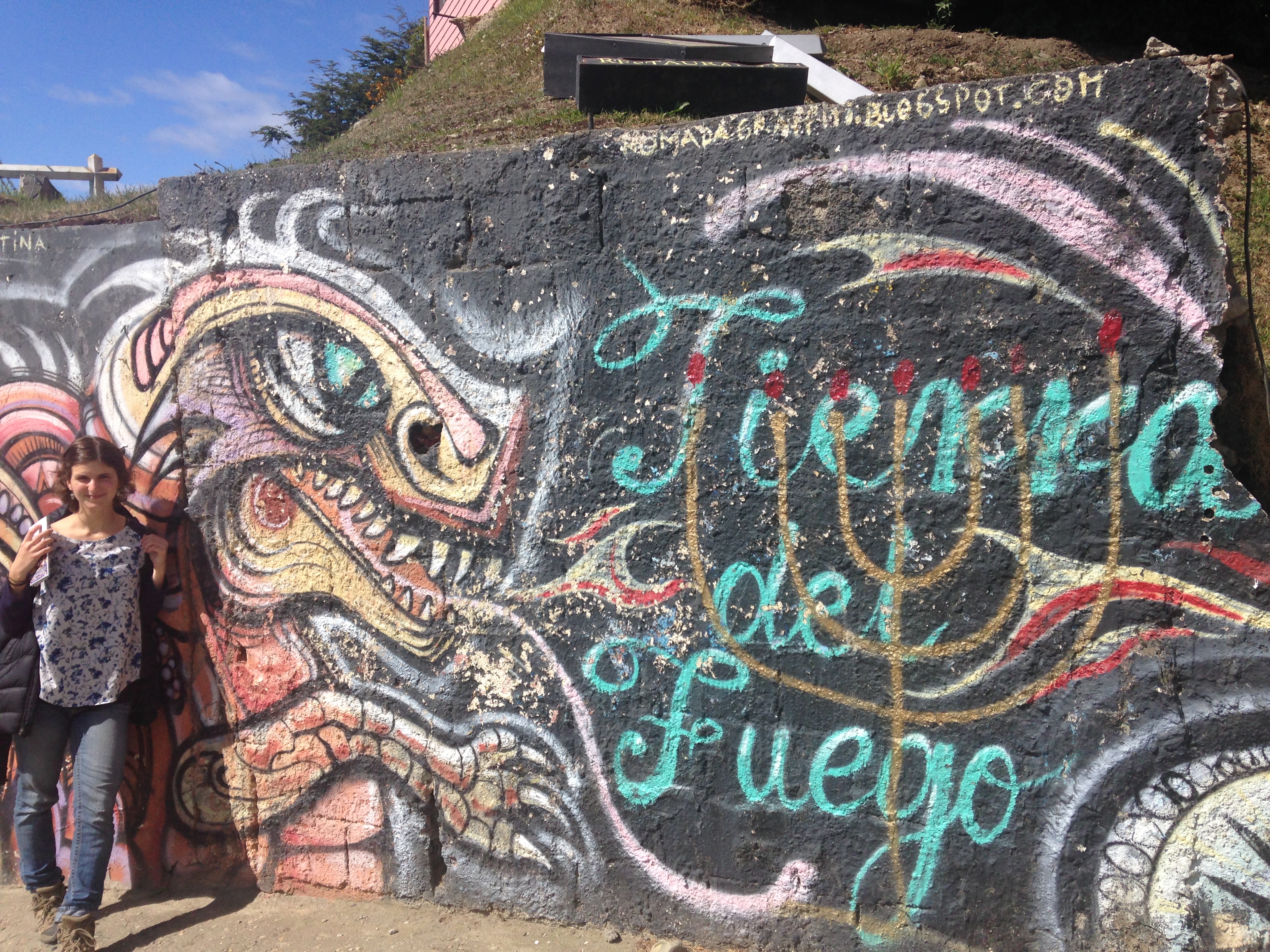
Mariana poses with some Ushuaia street art
We spend a day prepping for the trip. Learning from our last expedition, we’ve become more efficient. Bead gets crushed and goes bad. Spaghetti is so wonderful at the end of a long day. Duct tape is always useful. Oh – and thank heavens for that economy-sized pack of beef jerky from Costco that we bought back in Boston!
We also rent trekking poles (essentially ski poles), as we’re now expecting to deal with some snow and learned that having that extra point of contact can make all the difference, especially when carrying a heavy pack.
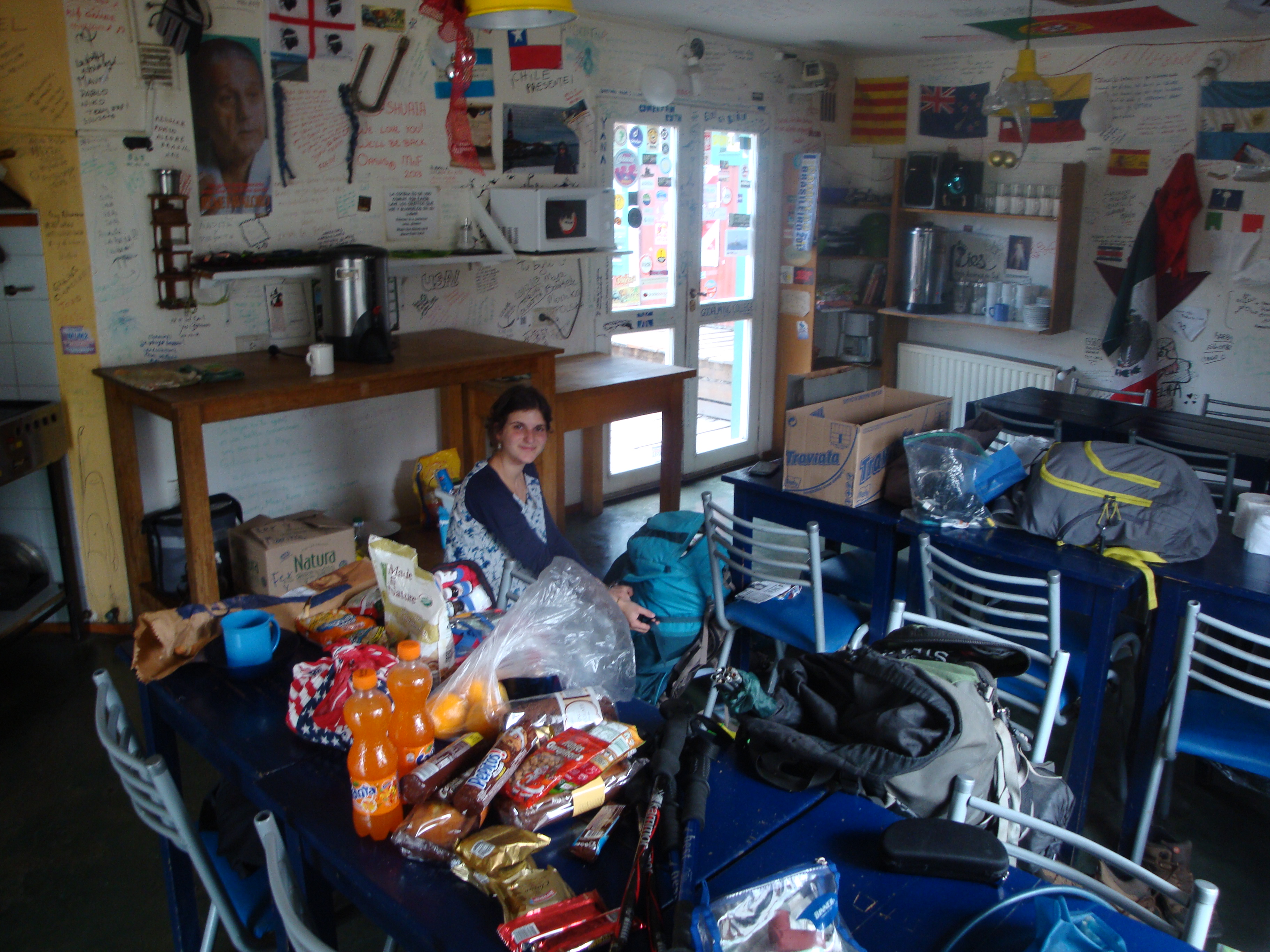
Finishing up our packing in our hostel’s common area.
Our prep day takes forever, and it’s after 7pm as we load up the cab that’s going to take us to the starting point of the circuit.
“Where are you headed?”
“Well, it’s about 13km up the highway. I can show you on a map…”
“Oh, you mean the Valle de los lobos?”
“No, I think it’s a bit before that.”
“What is this place you’re going?”
“Well, it’s the start of this hiking trail. It’s just a pull-off point on the highway. Apparently there’s a big yellow pipe that runs under the road…?”
The big yellow pipe is apparently enough for his mind to hone in on the spot and we’re off.
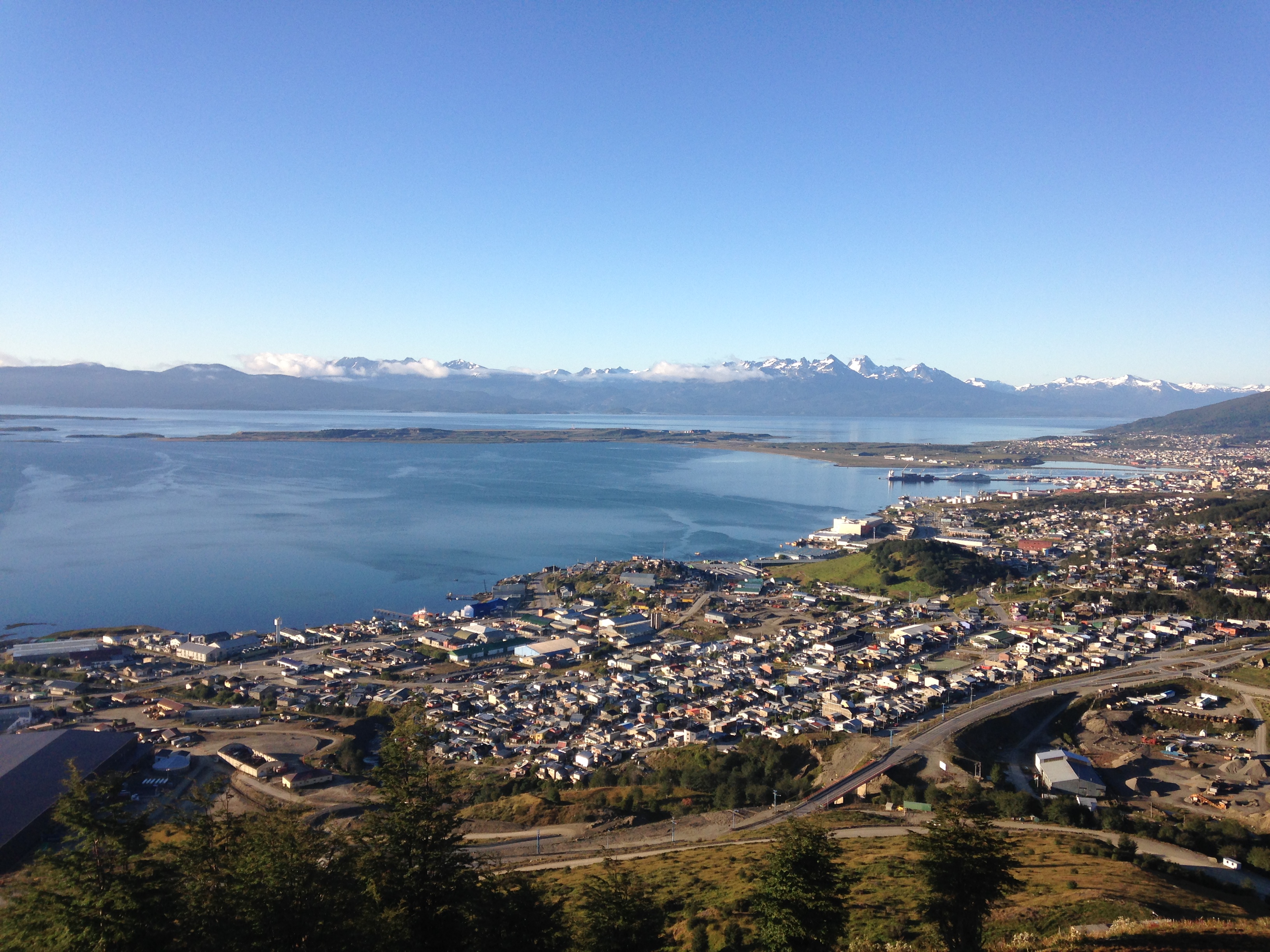
A view of downtown Ushuaia on the cove of the Beagle Channel. The mountains across the water are in Chile.
We drive through the outskirts of the (surprisingly large) city. Despite being at the end of the Earth, Ushuaia has seen an enormous amount of growth in the past few decades. Our cab driver, Norberto, like almost everyone we’ve met, was born in Buenos Aires and relocated to Ushuaia for work. Because of the relatively brutal winters and high demand for labor (Ushuaia is an extremely important port for ships traveling around the bottom of South America and for cruises and scientific vessels headed to Antarctica), wages are uncharacteristically high. This drove a Gold-Rush type of growth in the past half century that led to the bustling, working-class Port City that we drive through today. Not bad for a town that – like Australia – was first relegated a prison colony.
On the edge of town, we pass a massive wooden archway with USHUAIA emblazoned across. We’re leaving civilization – entering Jurassic Park.
We find our big yellow pipe and pull off to the left on the dusty shoulder. Norberto helps us unload our packs and we thank him for driving us so far. He asks us where we’re headed and we point into the dark forest ahead of us. Above, several distinct chains of mountains loom.
“I think we’re heading to the right of those big mountains,” I say, without an enormous amount of confidence. “Then, the plan is to follow that valley and pass up over the back of that range, and come back down the other side. We should end up about 10 kilometers closer to town in four or five days.”
“Wait – does anyone else know you’re out here? Know where you’re going?” Norberto seems genuinely concerned.
“Well, our parents kind of know that we’re going hiking, I guess. They know the name of the circuit…”
“Okay – I’m going to come for you,” he cuts me off. “What day did you say? The 31st? Okay, I will be here on the morning of the 31st. Waiting.”
We convince Norberto to give us his phone number and we’ll call him from the RV campground near where we’re due to finish. We also give him the name of the hotel where we’ll be staying when we get back, and tell him to call there if he hasn’t heard from us.
At first, we chuckle – Norberto’s fretting seems silly and mother-hen-ish. But, without saying anything, we both wonder if maybe he’s right. Maybe we’re biting off more than we can chew.
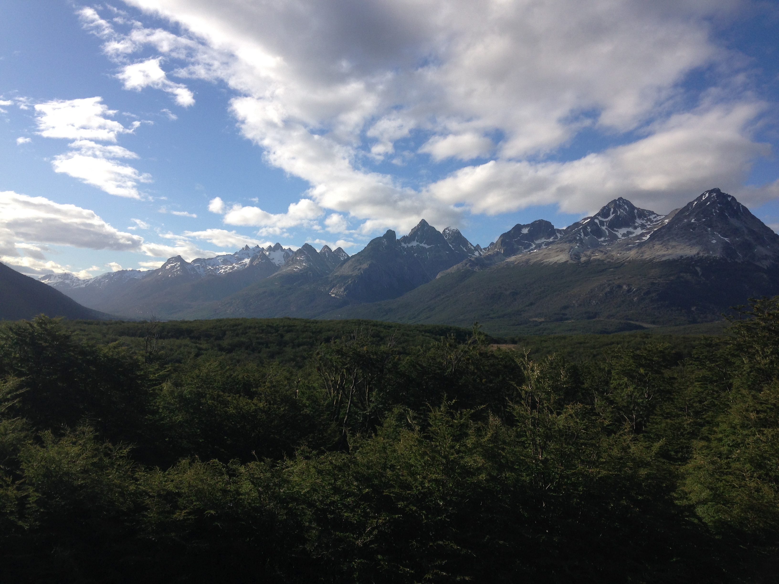
The Sierra Valdivieso – where we’re headed!
The day is beautiful – perfect. And there’s so much of it (day, that is)! Even hitting the trail at 8pm, we have a solid 3 hours of sunlight.
Ushuaia – like most of Patagonia – is known for awful and awfully unpredictable weather. Yet, our first few days here have provided us mostly blue skies, warm sunshine, and little of the extreme winds we’d heard so much about. Part of me doesn’t want to jinx it; part of me is waiting for the rapid reversal of fortune – right when we’re deepest in the woods.
But, for now, I enjoy the view. Even from this main road, the majesty of the mountains and wilderness around us is startling. But we can’t stay here all night. We head into the forest.
Approaching camp 1 – after 10pm and the sun is still out.
This first leg is short and the only segment that’s actually on a clear path – a wide, muddy ravine that’s been carved out by ATVs leads us through the forest. Already, we’re glad for the poles, as we sometimes wade through knee deep mud. Seeing the damage to the land caused by the machines summons an unreasonable anger at these unknown riders. I want to stuff their faces into the deep muddy tire tracks in the the otherwise pristine forest and say “SEE?! THIS is what you do!”
We only hike for a couple hours before arriving at a small hut – the last outpost of civilization. Another couple occupies the inside and we’re content to set up camp in the grassy field beside it. It’s after 10pm, but still bright as day. I can’t get over this.
Campsite #1 at dusk.
When we wake, the skies are still clear – I can’t believe it! – and the sun has been up for hours. The other couple is packing up to leave (they’d just walked out here for the night) and we’re getting ready to head into the back-country. I’m excited.
We have a map with a red dotted line that shows where we’re meant to head. Major landmarks (lakes, rivers, mountain peaks that can be gleaned from the topography) are our greatest sources of confidence. We also have a small GPS beacon that shows us our exact coordinates, in case we get disoriented. Finally, we have the written words of our friends from “Trekking in the Patagonian Andes” which give a basic description of the route.
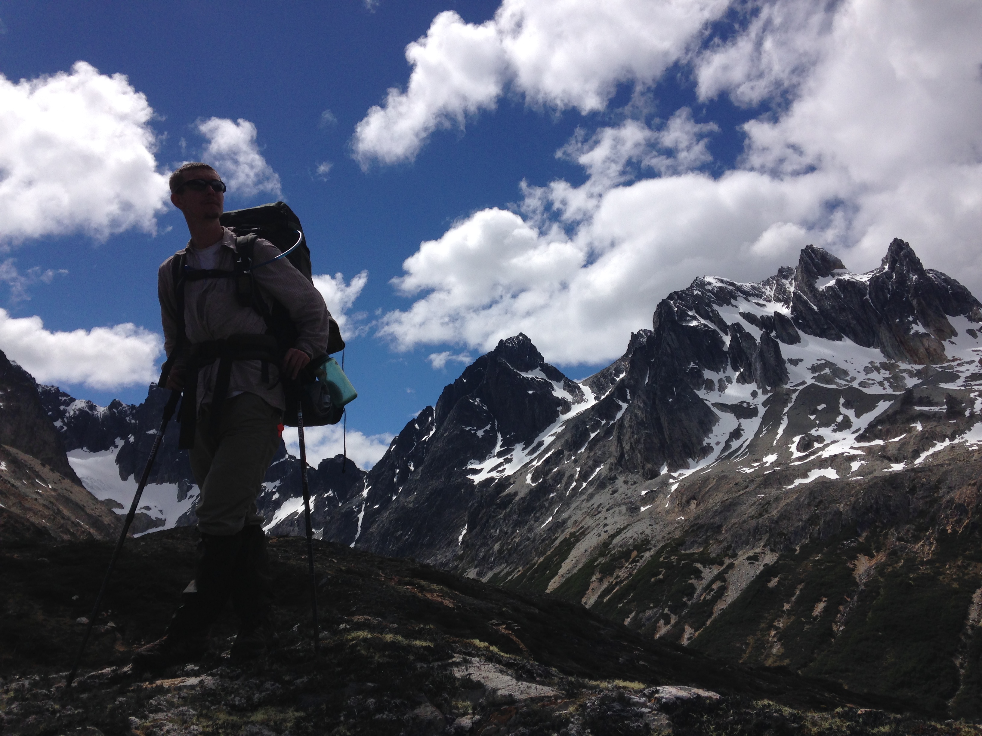
A joyful, sunny, dry first day in the back-country
The first day is joyful. The weather cooperates; the route is challenging, but not impossible; the mountains sparkle; the panoramas take our breath away.
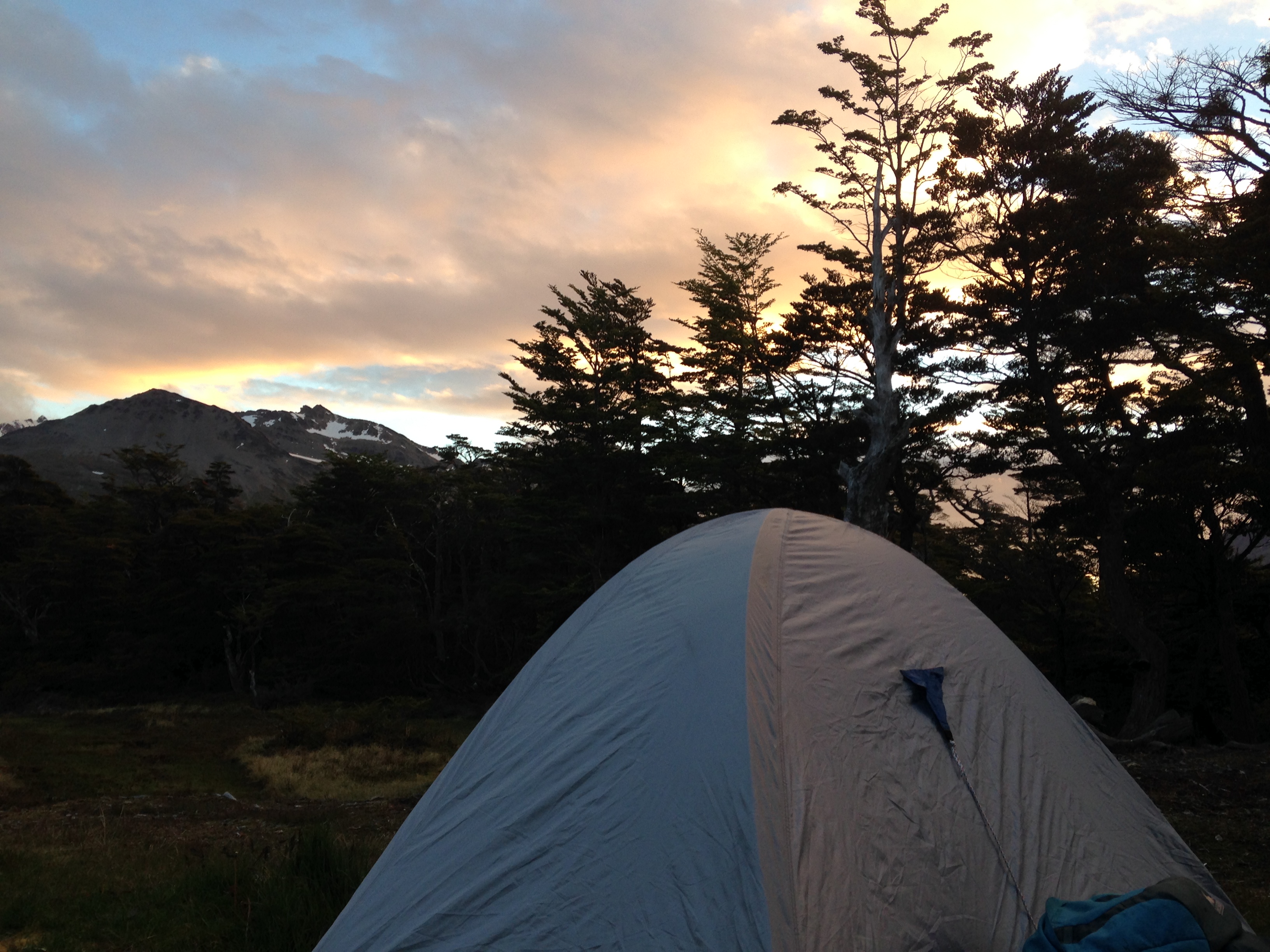
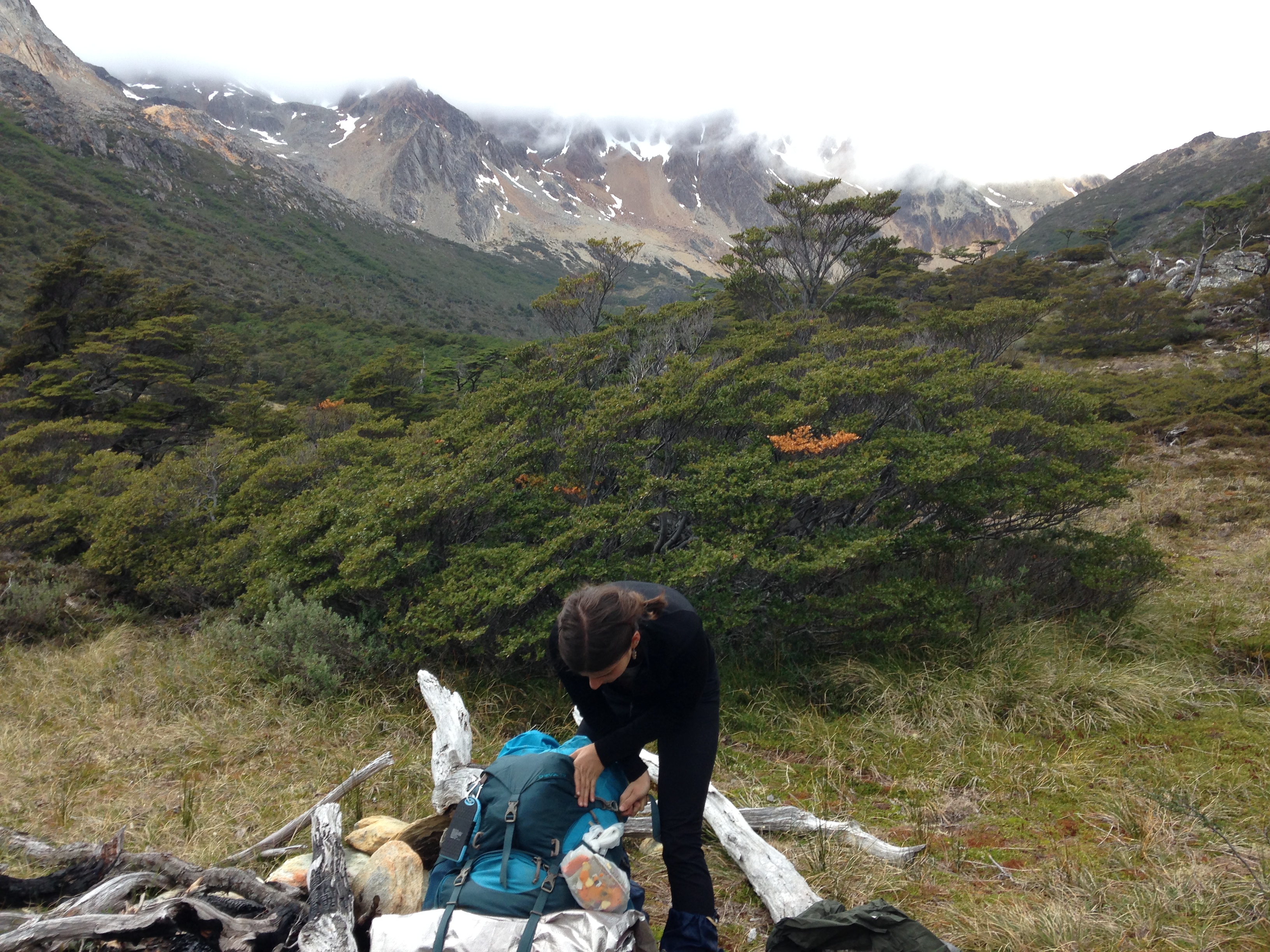
We arrive at our first campsite with a feeling of self-righteousness. We can do this! We set up the tent and pack up our things inside. A slight rain has started and I worry that our packs will be soaked if we leave them outside.
But that’s no problem for us – we know what we’re doing now! And so, the two of us, along with our packs (easily worth another person), and pungent boots (worth at least another person’s smell) clamber into our tiny tent. I can barely straighten my legs, but somehow I’m tired enough that I fall asleep within minutes.
Clouds rolling in as we set up camp 2
In the morning, the rain has not stopped. But this cannot stop us – will not stop us. We’re ready for some poor weather. We can hike and navigate and survive out here: rain or shine.
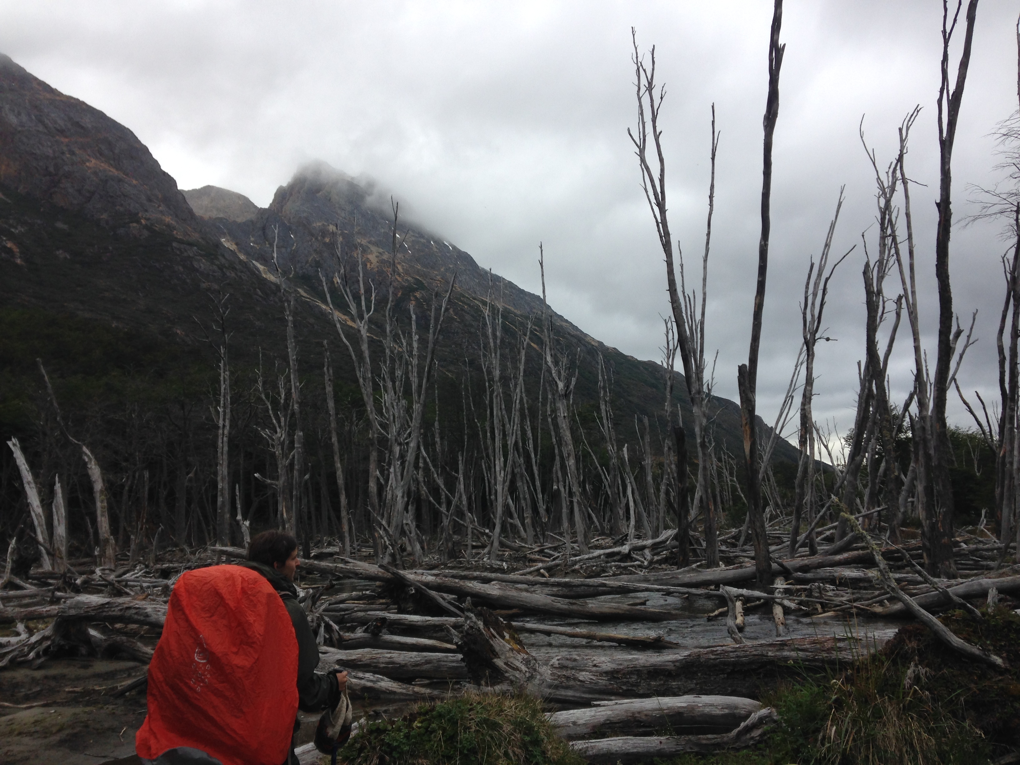
We pack up the tent and head off. Through the valley, we follow a gentle river before cutting steeply up a thickly forested ravine. The trees are short and scraggly – the result of a recent forest fire – their bare black limbs a haunted forest.
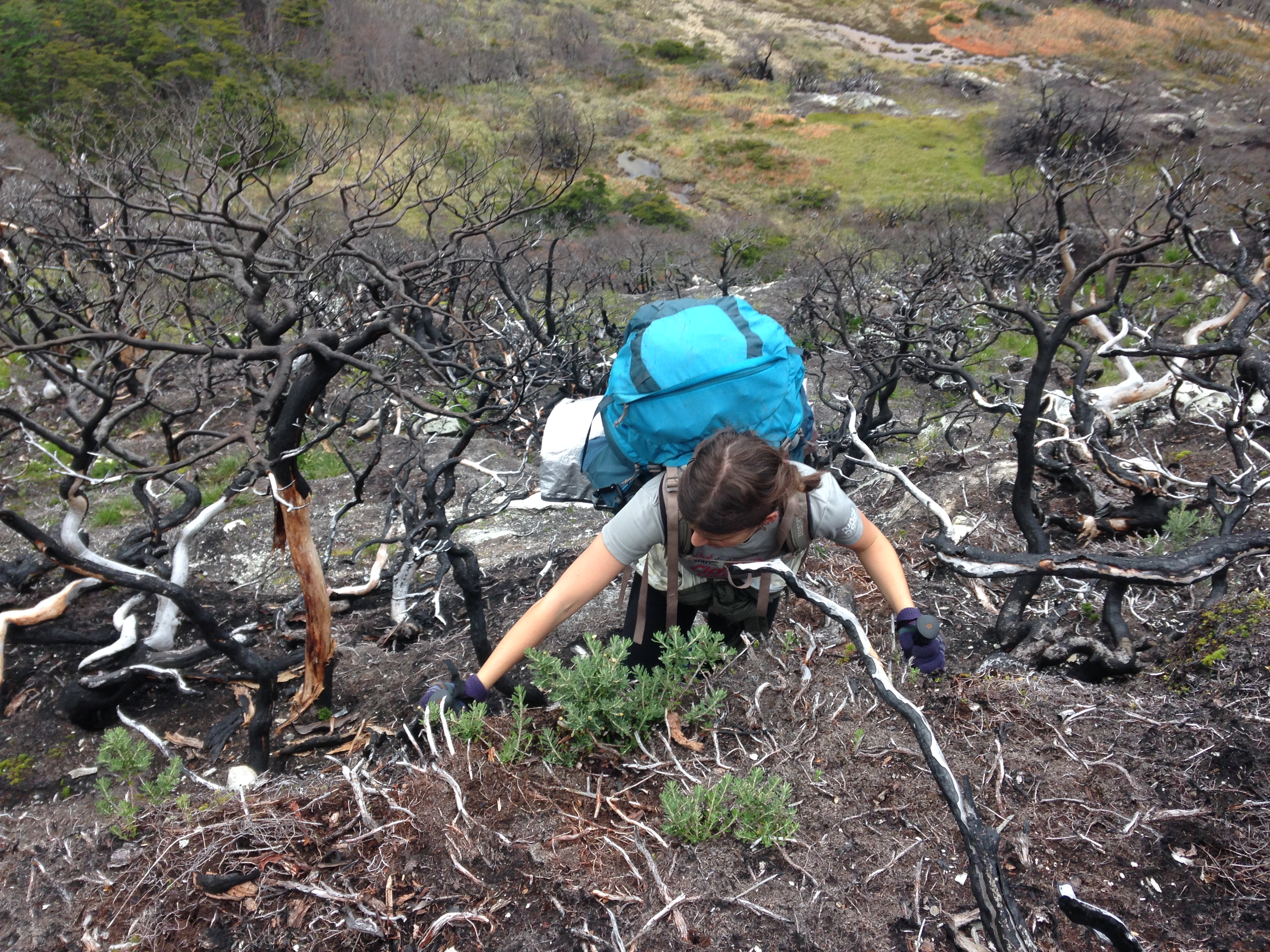
Climbing up through the haunted forest.
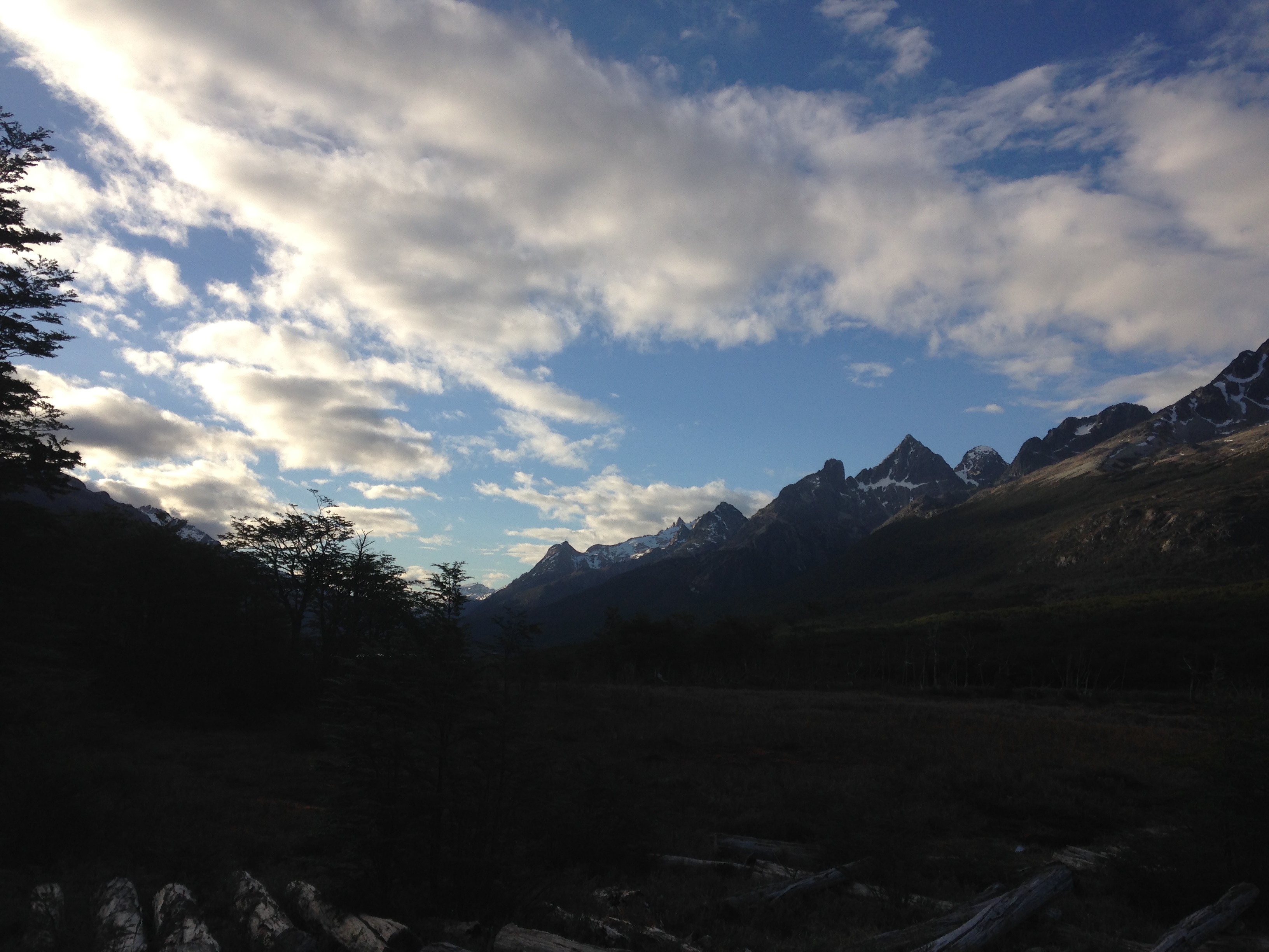
Up and up – from one plateau to the next, each one a 20-minute stairmaster workout. The fog is starting to roll in now and covers to peaks around us. I think that’s where we’re headed.
I’m right. We pause for a snack at the oh-so-originally named Laguna Azul (Blue Lake), and then proceed upward, into the clouds and snow.
A white-out. I can see a few feet of white in front of me – enough to make sure I don’t walk off a cliff – and I’m grateful for a compass and GPS to make sure I’m at least headed in the right direction. Rather anticlimactically, we reach the top of what I’m sure is a spectacular pass and do not stop. The wind whips and I’m excited to be heading down, down – the air and fog thinning, the wind calming.
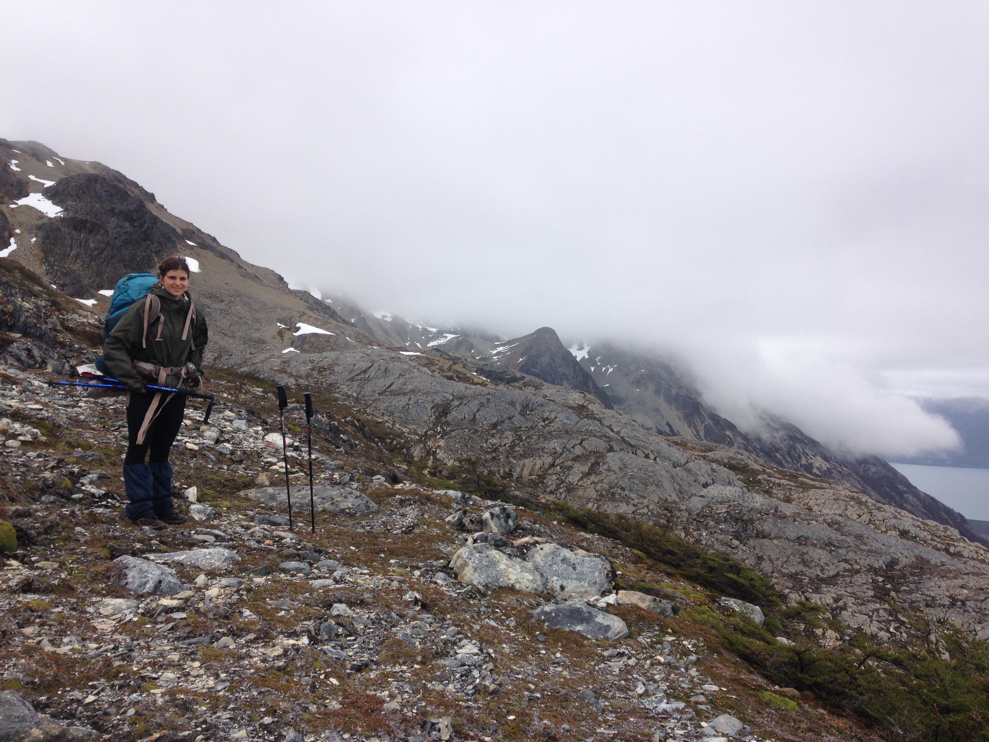
Preparing to enter the clouds!
By lunch, the rain has stopped and so have we. We’re perched on a hilltop overlooking another gunmetal mountain lake. The fog has lifted and we have just one more high pass for the day. We don’t pause for long.
The next climb is shorter. Up and over. We pause again for beef jerky and chocolate bars and decide to push on for another few hours. The weather is more or less cooperating now and we decide to take advantage of it and continue into what we had planned to walk yesterday.
The few extra miles lead us down-stream along the left bank of the Rio Olivia (Olivia River). Tomorrow (our last day, we hope), we’ll follow the (relatively) flat terrain along Olivia’s banks for most of the day before crossing just a few miles from the road where we started. I cook spaghetti with meat sauce as a light rain pitter-patters our tent. The hard part is over.
A wet day awaits us.
As I unzip the tent in the morning, I’m glad we had pushed on the afternoon before. The rain has returned in full force over-night, which means today will be wet and muddy. As I go to fill our bottles from the river for our morning coffee, I can’t find the small patch of grass where I knelt just 12 hours ago for this same process. Alarmed, I realize my spot from yesterday is now submerged under the murky, flowing water. The river has risen at least a foot.
This fact looms over both our heads as we pack up shop and hit the trail. The rain is still falling which we both know means that the water will only continue to rise. All I can think about is that – at some point – we have to get across this river – this wide, deep, dark, powerful, very cold, and (most importantly) bridge-less river. Suddenly, the words in our friendly little guide-book describing the “knee deep” crossing at the end of the route begin to seem daunting.
But we forge ahead – naively optimistic. We cross a few tributaries – removing our boots, rolling up our pants, and wading through the mid-shin, frigid waters. Each time we cross, I think about all that water flowing into Olivia – her current getting stronger, deeper.
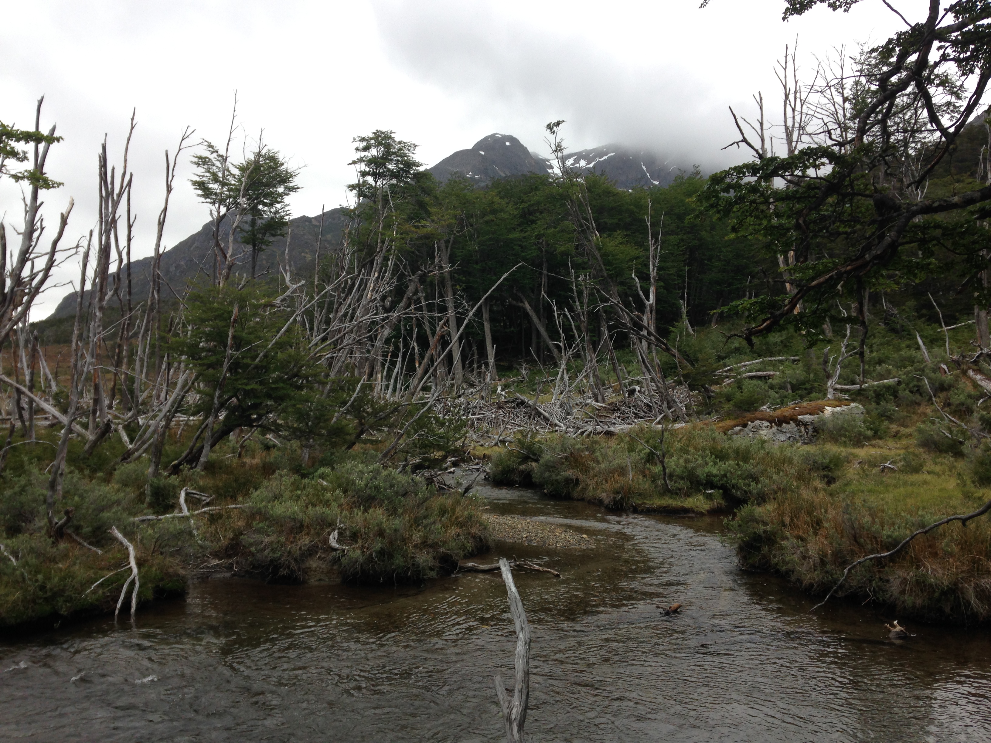
The day’s hike is slow and frustrating, as I’d predicted. A mess of muddy banks, flooded beaver ponds, and glacial streams. Between the constant rain from above and the muddy water below, we’re entirely soaked.
Navigating through beaver land.
Finally, we come to the moment of truth. It appears that our arch-enemies (the beavers) may have actually helped us, as a large dam has reduced the swollen Olivia to a much more manageable size – nothing worse than the tributaries we’ve crossed already. Once again, we roll up our pant-legs and, barefoot, wade through the soft, sandy bottom.
“I really hope that was it,” I say on the other side of the bank, as we try to dry off our feet before shoving them back into the already soaked socks and boots.
A small hillock sits between us and the Laguna Mariposa (Butterfly Pond), where we’re to follow the edge just a few short miles back to the road. We’re maybe an hour away from sitting at our campsite, pitching our tent, eating chocolate, drinking hot tea.
But as we reach the top of the hill, a devastating realization hits me that, no, we did not just cross the Rio Olivia, but just another (albeit, wide) tributary. Somehow, we’d grown separated from Olivia and now she stands in front of us – more powerful than ever, small white-caps popping up over rocks and logs.
The next hour is one of the most brutal of the trip. With the realization that we still have the river crossing in front of us, we make our way through extremely challenging terrain – a flooded swamp overgrown with dense clumps of stinging nettles, their long needles piercing our skin through gloves and pants and even our fancy synthetic raincoats.
Torn up, exhausted, and more than mildly concerned, we arrive at the riverbank, where we walk up and down, desperately trying to find an easier spot to cross. Somewhere narrower? Well, then won’t the current be stronger? Or it’d have to be deeper? Right, we want a wider section, where the water will be calmer? Right?
We can’t see the bottom, so I find an overhanging log and I crawl out onto it with my trekking pole to test the depth. As I plunge my pole into the dark water, my hand reaches the surface – the entire pole submerged – and I haven’t touched the bottom. I keep pushing down. The water is up to my elbow, my shoulder.
We can’t cross here.
We sit down and each have one of the energy gels which I’d picked up in hotel hospitality suite at some road race – a time and location that seems infinitely far from our current predicament. As we shiver and consider our next steps, I see two baby geese across the river. They waddle into the water and effortlessly float downstream, crossing as they go. Mama Goose is waiting on the other side and within thirty seconds, the family is reunited.
But we are not geese.
We weigh the options. We have about one day’s extra food. We also have the time pressure that my parents will be arriving in the evening of the following day, at which point, if we’re not there to meet them at the airport, and not at the hotel, there will be serious concern. We do have the GPS which can serve as an emergency beacon in life or death situations. But we’re not there yet.
“This is not an emergency,” I’m trying to calm Mariana (and myself) a bit by talking things through. “This is not an ideal situation, but it’s not an emergency. It makes us vulnerable – closer to a real emergency. What would make this an emergency? Well, if one of us got very hurt – broke a leg or even sprained an ankle and could not walk (at least not very well). If one of us got hypothermia, which would probably happen if someone was entirely submerged in water. If one of us lost one of our packs and we lost something really crucial like sleeping bags or the tent. But right now, we’re not there yet.”
To avoid putting ourselves in an emergency situation, we rule out the idea of trying to cross the Rio Olivia. There’s no safe way to do it without risk of potentially fatal total submersion.
So, we need to keep walking.
We have two options. One is to retrace the steps of our entire journey. This is the only guaranteed way we know back, but it’d require retracing three and a half days of hiking and would almost certainly get us back long after my parents arrival and that would be a relatively large problem for aforementioned reasons.
Option two is to ditch the guidebook and stick with the map and our eyes. Because we’re making a loop, we can essentially cut back towards the trail where we started. As long as we don’t hit any other major impassable rivers, we’ll theoretically hit that torn-up ATV trail if we just kept walking in the right direction. There’s no saying what’s lying between us and that trail – on the map, it looks like a whole lot of wetlands, which I fear might be flooded – but to me, it’s our best bet.
And so, we set off – heading away from the relative comfort of guidance and into the unknown.
Fueled by a new adrenaline – this is…serious, dangerous! – we quickly make our way around Lago Mariposa and to the border of the forest and the wetlands. I figure we’ll follow this line north. It should be a bit drier than walking through the middle of the plain and a bit easier than walking through the dense woods.
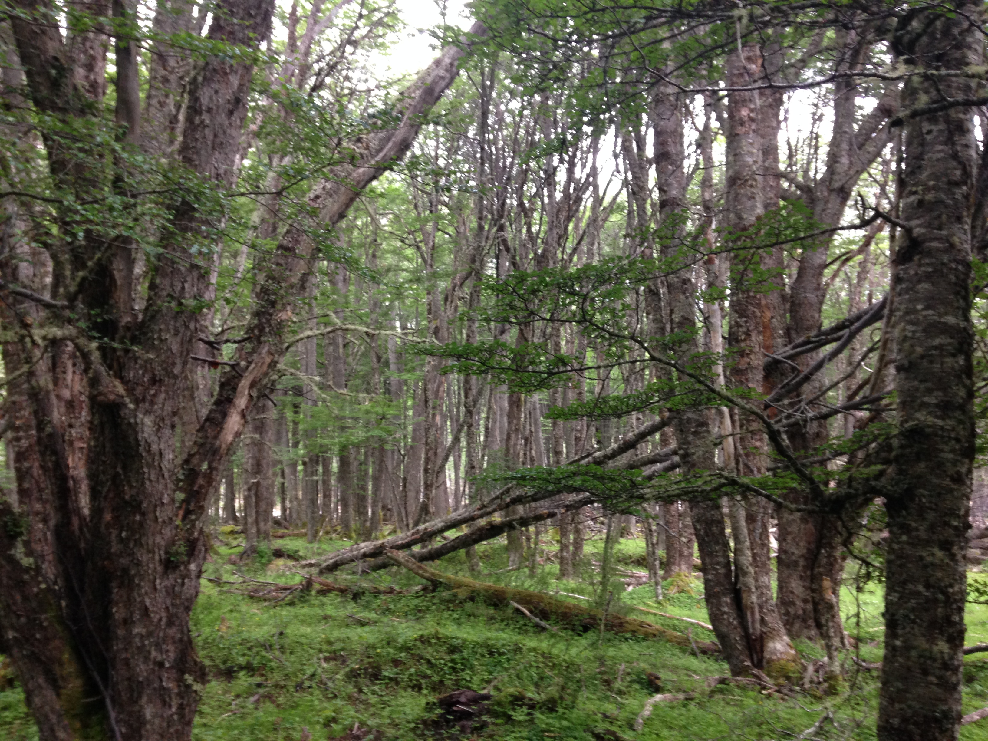
Through the forest.
There are a few more small river passes – each time, I’m waiting for the giant, wide menace to appear, Olivia’s evil twin, but each time we make our way across, wet from the knees down, but in one piece. There are a few places where we are – literally – hopping across the swamp on what are essentially giant lilypads. We navigate a maze of tiny strips of land poking out just above the surface of the murky depths. There is water and more water and mud but we’re making progress.
We come to a large beaver lake where we’re forced to walk across the top of the dam – an enormous wall of water to our right being held up by sticks and beaver shit. I hold my breath and step lightly.
But then we start to see horse poop – a welcome sight, as it means we’re not alone in the virgin forest. I do my best to follow the horses’ tracks and every once in a while, we even seem to be on some semblance of a trail.
It’s a nerve-wracking few hours, but finally we come to a clearing where those heinous ATVs have torn up another section of the forest. Immediately, I transition from desparate to find this exact trail to once again furious at the thoughtless hooligans that did all this damage. Despite the stress that this wilderness has caused me, all of my frustration and anger is redirected at man and our arrogance and disrespect of nature.
Within another hour, we’re back at the cabin where we’d spent the first night. We light a fire, hang our clothes to dry, and eat almost everything that we have left.
In the morning, we pack up for the last time and walk along the familiar trail back to the road, where we’re picked up by the first car that passes us. Today is New Year’s Eve.
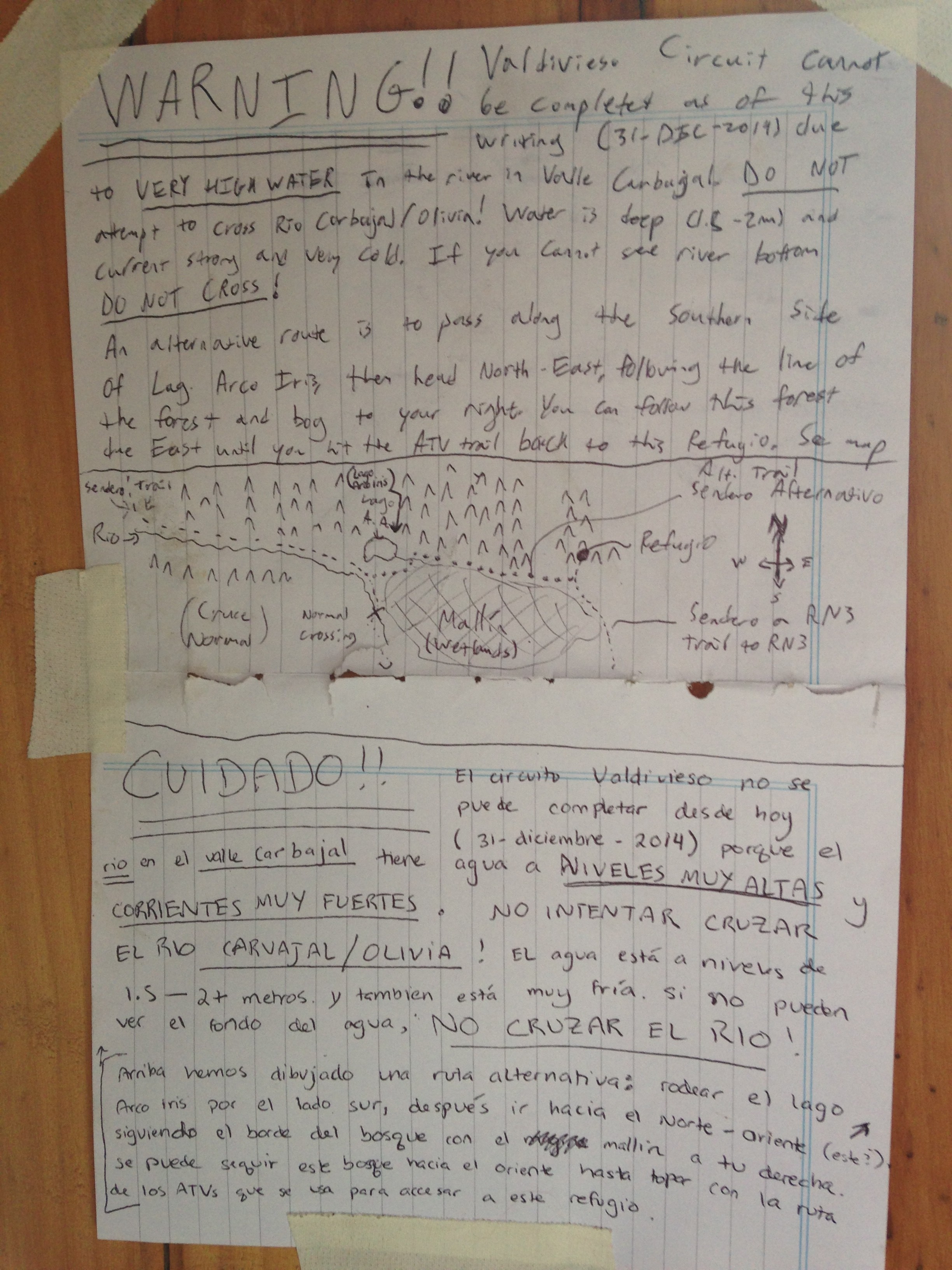
We leave a warning to other would-be trekkers in the cabin, including a map of our improvised route.
(Postscript:) Back to Ushuaia
Back in civilization, the juxtaposition is hard not to notice. The heated restaurant where we have lunch is one thing, but then we head up the hill to the hotel where we’ll be staying along with my folks for the next few days.
My parents had decided to join us for the final week and a half of our journey at my own encouragement. Always trying to push them out of their comfort zone, I figured flying to the other end of the world and seeing some big ol’ mountains, meeting a lot of new people, and spending some time together would be a great combination.
That being said, my parents simply have higher standards than me (or Mariana), and so the hotel, where we find ourselves scrubbing off five days of wilderness, draws extra attention to how our circumstances have changed in the past 24 hours (when we sat in a thornbush, river side, wondering how we were going to get out of there).
Now, we’re wearing jeans and sitting in a taxi on the way to the airport where my parents are due to arrive shortly.
I’ve spent a lot of time waiting for people at airports (it’s a big part of my job with STRIVE each summer), and so I’ve developed some fun games, which you should feel free to replicate. Besides the general people-watching, one of my favorite games goes like this.
1. Think of a funny word that’s not super common (say, “Clownfish”)
2. Think of a way to spell that funny word that might look like a weird name in a different language (hint: use lots of accents, those dots above U’s, hyphens, apostrophes, etc.). Example: “Kloün-Fisch”
3. Write out this spelling on a piece of paper and hold it at chest level to blend in with all the other taxi drivers and tour-guides that are there to pick up their clients.
4. Call out your name/funny-word to every person walking by who likes like they speak English. Enjoy their reactions and remain wonderfully entertained at each double-take you get (“Did that dude just shout “clown fish” at me?”
But, I don’t have to wait too long. Shortly enough, my parents (hereafter referred to as “The VC” – explanation forthcoming) pop out of baggage claim – bleary eyed, but excited to see us.
A cab takes us back uphill to our hotel and we spend a few hours catching up, enjoying each other’s new and refreshing company. We all rest – exhausted from our various expeditions, each long and grueling in their own way – until beginning a long, late-night dinner (though, it is still very much day-time outside).
It’s barely dark by the time the whole room counts down to midnight. We toast and smile and take photos and aren’t up much longer before we call it a night.
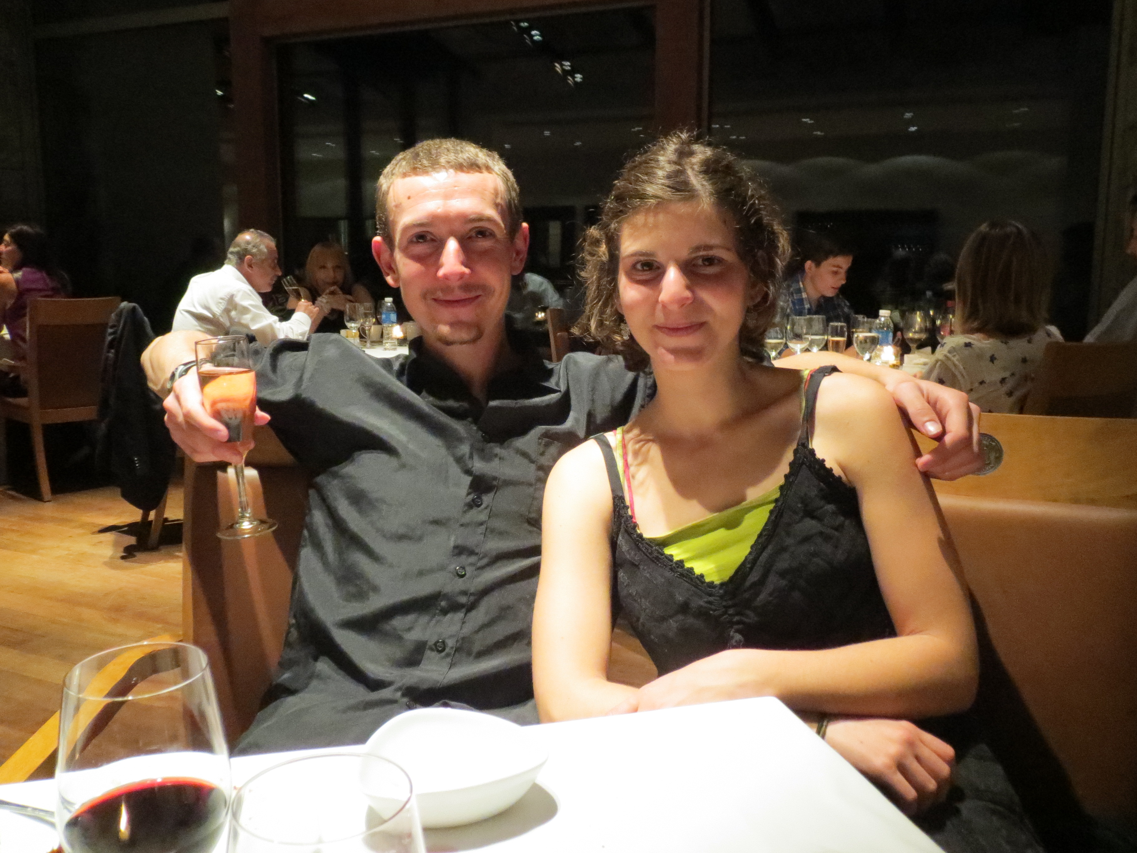
Happy New Year!
The next two days are a blur of activity. In contrast to the slow, meandering pace of our journey up until this point, the VC don’t have the same luxury of time that we do, and our time together is driven by an impossible desire to see as much as we can while remaining well-rested.
But, (as the Number 1 travel guide), I do my best to cater to everyone’s desires.
We go for a short hike in the surrounding hills. We take a boat ride to an island full of Penguins – an island where (if one can survive the freezing rain and driving wind), one can walk right up to and photograph these tiny creature who seem entirely unbothered by our presence. And yes, penguins are just as cute in real life as in the pictures.
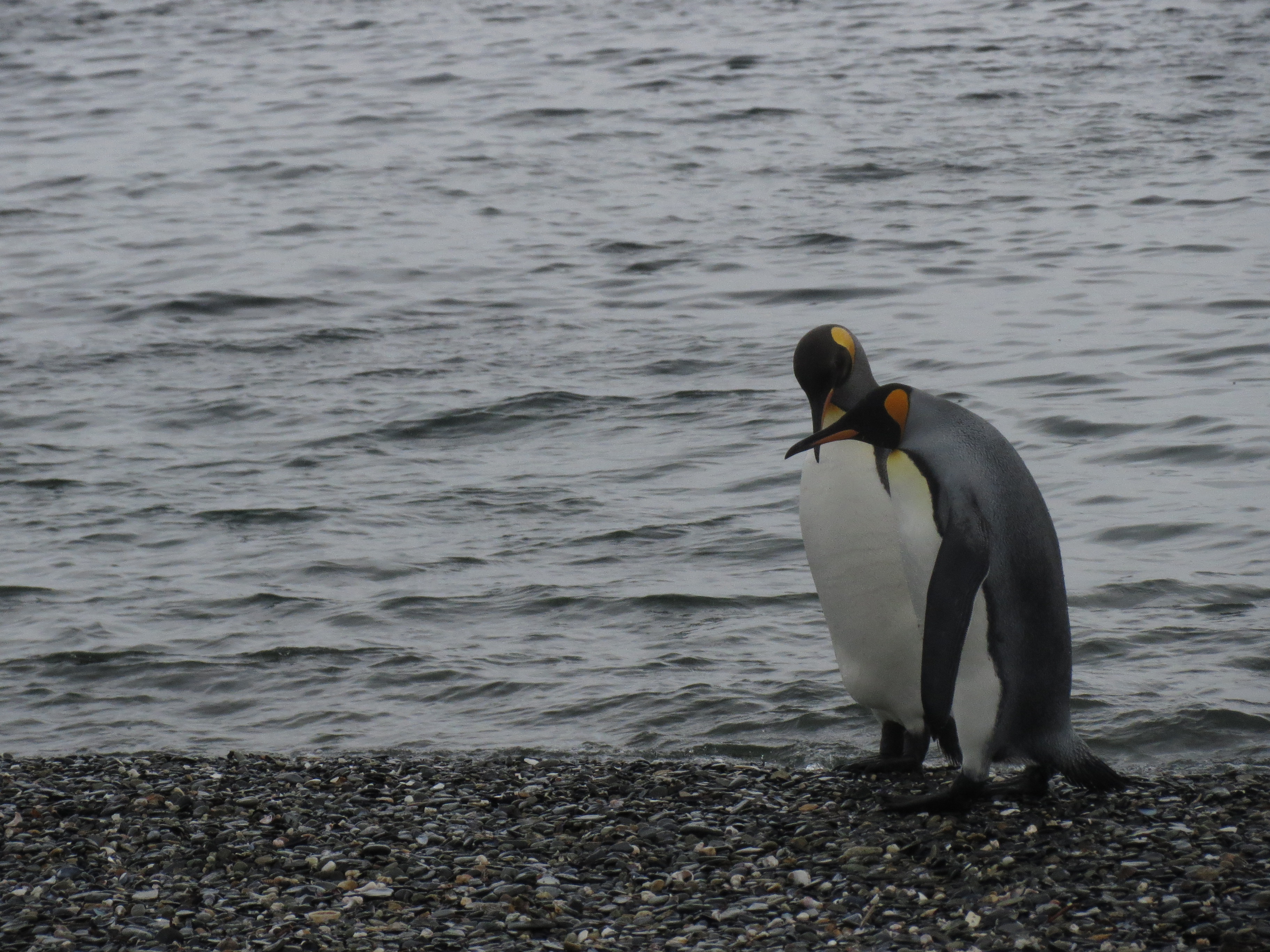
Penguins.
On our last day in Ushuaia, I wake up at 4am to run before a long day of travel. The sun’s already been up for an hour or so, and it actually doesn’t feel so bad. We have breakfast together before piling all four of us into cab to heading back to the tiny airport. At security, they confiscate my tiny pocket knife that I’ve had for close to a decade (and, of course, had forgotten to take out of my carry-on). Security theater…
We board the plane knowing that we’re heading back north – towards home. We still have a few more stops, but this, right here, is the greatest distance we’ll be. It may be a circuitous route, but we’re on our way home now. The distance is receding.
Leave A Comment